Our Founder Stanley's Top 3 Favorite Leica Products On Display at World of Concrete
When you want innovative solutions so your business can thrive, you need the right tools and products to streamline your workflow.
Leica Geosystems products are used across a broad range of industries including surveying, mining, transportation, utilities, safety and security, and construction. Here at Datum Tech Solutions, we take pride in using top-notch products and we are excited to be displaying a few of our favorites at World of Concrete.
What is World of Concrete?
World of Concrete (WOC) is the construction industry's first, largest, and most important annual international event for concrete and masonry professionals across the globe. Datum Tech Solutions will be onsite, displaying the top Leica tools on the market today.
Here's a look at our founder, Stanley Lawrence's top three favorite Leica products on display at WOC.
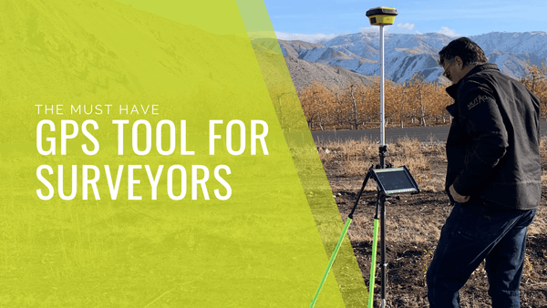
iCON GPS 70 T with Smartnet RTN

The iCG 70T Rover with Smartnet is the most versatile and efficient Construction Rover Setup on the market today. With Smartnet Real-Time Network corrections, you can establish a Site Localization with onsite control in less than an hour and have your Rover calibrated to the onsite coordinate system for the longevity of the project. Every morning following the initial setup, turn on the Rover, connect to the tablet with iCON Build Plus and commence layout/and or asbuilting. The iCG70T comes equipped with a tilt compensator that allows for layout and asbuilting at the tip of the rod (without plumbing), allowing much faster layout times and greater efficiency.
Visit our Instagram for behind the scenes updates from WOC.

No other laser scanner on the market combines ease of use with accuracy, speed, and efficiency, quite like the RTC360. This powerhouse of a scanner is truly easy to operate and cuts post-scan processing time down to next to nothing. VIS (Visual Inertial System) technology allows the scanner to track itself from scan location to scan location, thus giving the user the ability to register and align scans right in the field! Operating the RTC360 is a snap, with a light version of the point cloud downloading right to the Cyclone Register 360 App on your iOS or Android device. Here you can register, align, and even see your scanner's live location on your project. No other scanner has revolutionized gathering point clouds and full HDR photos like the RTC360.

Just as the RTC360 made enormous waves in the laser scanning and reality capture industry, The BLK2GO is here to pick up the torch, literally. This handheld scanner utilizes SLAM technology to simultaneously localize and map your surroundings, all while simply walking through one's environment. Dual-axis LiDAR allows the user to capture 420,000 points per second while providing best-in-class accuracy. Combined with its lightweight construction, rechargeable battery (providing 45 minutes of uninterrupted scanning), and onboard storage supplying six hours of scans, this scanner will gather scans in challenging and hard-to-reach places where traditional scanners simply cannot. This is the next big thing in reality capture, and a true game-changer.
Related: Explore the latest in handheld scanning technology with Leica Geosystems new BLK2GO
Datum Tech Solutions provides a team of experts who can operate our 3D Laser Scanners and Total Robotic Stations onsite. Contact us today for a free consultation!