What Is a 3D Point Cloud? A Guide for Construction
A 3D point cloud is a set of millions of individual measured points that together form an accurate three-dimensional record of a real space. Each point carries an X, Y and Z coordinate, and usually a color value taken from the scanner's camera. Viewed together they look like a photograph you can walk through and measure.
If you have ever needed to know the exact height of a duct that was installed three months ago, or whether a slab was poured level, a point cloud is the fastest honest answer available.
How a point cloud is created
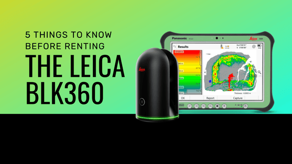
A 3D laser scanner sits on a tripod and sweeps a laser across everything around it, measuring the distance to each surface it hits. A modern instrument records on the order of a million points per second, and a single setup takes a couple of minutes.
The scanner only records what it can see. Laser light travels in a straight line, so any surface without a clear line of sight from the instrument simply is not captured. That is why one scan is never enough.
Why several scans are always needed
Every setup leaves shadows. The far side of a column, the space above a duct run, the inside of a stairwell. Moving the scanner and capturing the same space from a different position fills those gaps.
Those separate scans are then aligned into a single coordinate system, a process called registration. Done well, the result is one seamless cloud. Done badly, you get doubled walls and a model nobody can trust, which is the most common failure we see in data captured by people new to scanning.
On a straightforward interior, expect a handful of setups per floor. On a plant or a large industrial space, expect dozens.
What a point cloud cannot do
It is worth being clear about the limits, because they surprise people.
- It cannot see through anything. Not walls, not insulation, not ceiling tiles. If it matters and it is hidden, it needs to be exposed before the scan.
- Highly reflective and transparent surfaces are difficult. Glass, polished metal and mirrors either return nothing or return a false reading.
- It is a snapshot. A point cloud captures the building on the day it was scanned, nothing before and nothing after.
Reflective surfaces are the one that catches people out most often. A polished metal panel or a glazed curtain wall can return almost nothing, and the gap will not be obvious until you are back at the office. It is worth walking the space before the scan and deciding how to handle those areas, whether that means targets, a different scanner position, or accepting that some geometry gets measured by hand.
Accuracy, density and why they are different things
Two numbers get confused constantly.
Accuracy is how close a measured point is to the real position of that surface. This is what determines whether your as-built can be trusted for fabrication.
Density is how close together the points are. Higher density means finer detail and a much larger file. It does not make the data more accurate.
Scanning at maximum density on every job is a common and expensive mistake. It produces files your team struggles to open, and it does not improve the accuracy of the result. The right density depends on what you are capturing and what you have to deliver.
What you actually do with a point cloud
The cloud itself is rarely the deliverable. It is the raw material. What gets handed over is usually one of these:
- An as-built model. The cloud is traced into Revit or AutoCAD to produce intelligent geometry. This is what people mean by scan-to-BIM.
- Clash detection. Coordinating new design against what is genuinely there, rather than against a drawing set that stopped being accurate months ago.
- Verification. Comparing what was built against what was designed, and finding the discrepancy while it is still cheap to fix.
- Volumes and quantities. Stockpiles, excavation, cut and fill.
- A permanent record. A scan taken before walls close up is worth a great deal three years later when somebody needs to know what is behind them.
Point cloud file formats
You will meet a handful of formats, and which one you want depends entirely on what the receiving team uses.
- E57 is the open standard, and the safest choice when you do not know what software the other end is running.
- RCP and RCS are Autodesk ReCap formats, which is what you want if the data is going into Revit or AutoCAD.
- LGS is Leica's compressed format, small enough to share easily while staying measurable.
- LAS and LAZ are common in aerial and mobile LiDAR work.
Agree the format before the scan, not after. Converting is possible but it is wasted time, and some conversions lose information.
How to view one without specialist software
A point cloud does not require CAD skills to look at. Leica TruView lets anyone open, pan, zoom, measure and mark up a scan in a browser, which makes it the practical way to give a wider project team access without buying everyone a license or teaching them Revit.
For capture and registration in the field, Leica Cyclone FIELD 360 pairs with the RTC series scanners and registers scans on a tablet as you work, so you know the data is complete before you leave site rather than discovering a gap back at the office.
Getting a point cloud of your project
Two routes, and the right one depends on how often you need this.
Have it scanned. Our crews travel nationwide, capture the site, and hand over the finished deliverable in the format your team uses. Usually the cheaper answer if you need scanning a few times a year. See scanning services.
Do it yourself. If scanning is becoming a regular part of your work, owning or renting an instrument starts to make sense. We are an authorized Leica Geosystems dealer, so we can tell you which scanner suits the work, including when the cheaper one is the right one. Read the buying guide or look at rentals.
Either way, start from the deliverable and work backwards. What your team has to hand over determines the accuracy you need, which determines the instrument, which determines the cost. Tell us what you are measuring and we will tell you what it takes. Talk to our team.