Total Stations: Let's Breakdown Office to Field Data Transfer, Pricing and Equipment Options
If you make a living in the field of building and construction surveying you may be wondering what the golden rules of total stations are, especially as they relate to data processing practices, available total stations on the market, software solutions and pricing. We’ve rounded up some of the most asked questions directly from the mouths of construction surveyors to create your one-stop-shop for questions about Leica robotic total stations, Leica survey equipment and total station costs.
For the purposes of this blog, we’re going to focus on robotic total stations. While manual total stations are still widely used in the field of construction surveying, there are plenty of curious parties interested in streamlining their work with a robotic total station.
Robotic Total Station Overview
![]()
The capabilities of a robotic total station are vast and numerous. Put simply, total stations allow construction surveyors the ability to measure and log the coordinates of specific points, record distances from specific points of reference and measure angles and distances at the same time. As a construction surveying professional, there are five specific uses for a total station.
Measure Pole Tilt from a Height with Confidence
With a Leica total station, construction surveyors can confidently and accurately measure pole tilt from a height (pointing on the ground). Dually, a Leica total station allows construction surveyors to review a vertical line of a structure with a single face of the eyeglass, as long as it describes a completely vertical flat when turning it. This type of work requires a leveled second-hand total station to reduce the influence of vertical axis tilting.
Survey Construction Floor Plans
When performing any layout or location verification task within a construction floor plan, point position and height are determined by measuring angles and distances with a Leica total station. The instrument is placed over a point referred to a local coordinate system. For orientation purposes, a second point that is easy to distinguish is chosen after the horizontal circle is set to zero.
Construction Stakeout Surveys

When performing stakeout construction surveys, it is useful to extrapolate the sides beyond the limits of the excavation, to determine the profiles of the limits on which stakes are placed. During the construction process, ropes or cables can be tied to these reference points to indicate the wall positioning.
Automatic Recognition of Objectives
Leica Geosystems TCA reconditioned total stations features Automatic Target Recognition (ATR) objective recognition system. ATR recognition is achieved quickly and easily. This technology makes it possible to perform measurements automatically with computer assistance. The most widely used application of this feature is the accurate controlling construction machinery guide.
Measure Inaccessible Distances
Leica Geosystems total stations have a laser distance meter that does not require a reflector which is useful when you want to measure borders, place pipelines or take measurements along ravines or bars. Total stations make measuring hard-to-reach or hazardous locations possible and are a much safer option for construction surveyors out in the field.
Total Station Accuracy
![]()
Accuracy may be one of the most important considerations when contemplating renting or buying a total station. When construction surveying is performed accurately the first time, it saves companies time and money while giving surveyors peace of mind. These savings are also passed on to the customer — a win-win for all parties involved. If increased productivity and efficiency is what you’re after, an investment in a total station is a no brainer.
The Leica Nova TS60 is currently the most accurate total station on the market. With this total station in tow your team will minimize the risks and costs associated with downtime as well as unforeseen costs and delays that can cost you and your customer time and money.
The angular accuracy of the Leica Nova TS60 is 0.5” and its distance accuracy is 0.6mm + 1ppm. With touch technology and a user-friendly interface the TS60 can perform a plethora of construction surveying tasks in harsh environments — rain, fog, dust, sun and heat shimmer are no longer a barrier to a job well done.
Total Station Auto Leveling Capabilities
Like most things, the best way to learn auto leveling with a total station is by doing. Our team at Datum Tech Solutions has been field training those unfamiliar with total station capabilities for nine years.
First Time Robotic Total Station Training Program
Our team currently offers a two-day training program outlined below.
Day 1
iCON Training Includes:
- The initial creation of your project/job with a Leica total station
- Importation of all applicable files for job completion (AutoCad, CSV and Layout Points)
- Assisted sketching (grid sketching to determine points of control)
Fundamentals Training Includes:
- Basic Geometry
- Angular Strength
- Back-site Distances
- Limiting Error (101 crash course)
Instrument Set-up Includes:
- Proper Procedure breakdown
- Instrument Protection & Safety
On-site Instrument Set-up includes:
- Set-up steps for any location
- Angles/Geometry refresh
- Working Inside of the Angle 101
- Two-point check-in
Day 2
We launch Day 2 training with a recap of Day 1 training. Day 2 training outlined below.
Day 1 Review includes:
- File Import
- Sketching
- Follow-up questions
Set-up and Point Layout training includes:
- Change Orientation (NSEW)
- Layout of Points (relative to RTS)
- Layout of Gridlines
We then follow up both days of training with a review and continued support throughout the life of your project.
Total Station Pricing
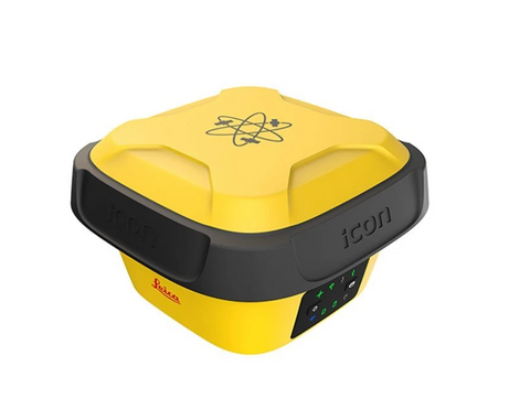
Leica iCon GPS 70 T: Starting Package $13,800
Request a quote for the GPS 70 T
Known for its resistance to magnetic interference and calibration-free usage the iCON GPS 70 T is able to measure and stakeout points quicker than ever before without the need to keep the pole vertical and level the bubble. Lightweight and rugged this handheld device is backed and supported by our team of experts. Increase your team’s productivity with easy, mobile work on-site.
Leica iCon iCR80 Robot: Starting Package $22,500
Request a quote for the Leica iCon Robot 80
The iCON Robot 80 features the most robust automated-aiming, lock and re-lock technology in the market. The iCR80 is especially useful in congested sites with many distractions, such as reflections, machines and people moving around. Challenging and changing site conditions should not be an obstacle with this total station by your side.

Leica iCon iCR70 Robot: Starting Package $17,500
Request a quote for the Leica iCON Robot 70
Widely used in the building construction industry, the iCR70 allows teams to move away from traditional analog measurement methods to modern digital layout techniques, which are a necessity within modern BIM processes and achieve the high productivity and accuracies demanded by the building construction industry. Even better is that the iCR70 requires minimal training and does not disrupt existing construction processes.
At Datum Tech Solutions we offer the Leica iCON Build Construction Software solution that integrates seamlessly with the total station of your choosing. Our resident software expert and CTO, Reid Flamm, works with our clients to provide support prior to, during and after your project has been completed. We’ve designed a robust training program for those new to total stations and those looking to develop their skills.